| Arddleen, Pool Quay, Buttington section. |
| This section is navigable and if changes occur you will find additional photo's and information added to the page. |
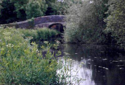
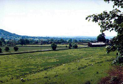
| After leaving Burgedin Locks and heading towards Newtown, the canal passes through open countryside. |
| These pages have been created without "frames" to reduce problems for some browsers. If you take time to read the script, the photo's should load as you scroll down. |
 |
This section is navigable and small craft can be launched from a slipway near to the winding point at Red Bridge ( Bridge 106 ) . Access can be gained by taking the B4392 towards Guilsfield . Turn left over Bridge 104, then immediately turn right to pass by Burgedin Locks. Continue down this narrow lane until you pass over Red Bridge . The access to the slipway is on your right. |
|
|
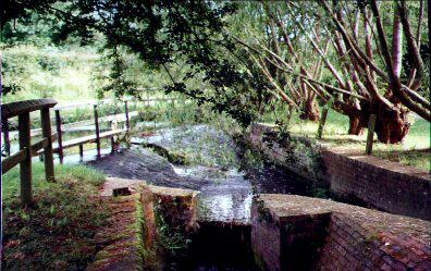 |
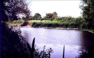
Adjacent to Red Bridge ( 106 ) is the overflow weir to the river. This was used in the past to power the former Wern Corn Mill by the side of the canal. (Now only a trace of the buildings remain.) Also nearby was a brick and tile works (owned by the canal ) and served by a narrow gauge railway from the nearby clay pits. The clay pits now form part of the Clay Pits Nature Reserve. Picnic table and parking area is by the entrance. |
|
|
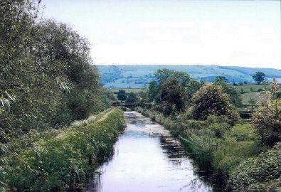 |
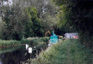
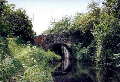
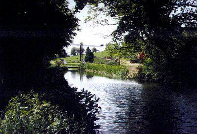
This photo was taken from Wern Bridge (Bridge 107 ) , situated just after the Clay Pits Nature Reserve. A family of swans reside here. Tanhouse Bridge (Bridge 108) can just be seen in the distance. |
|
|
|
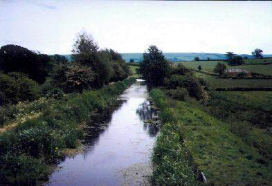 |
From Tanhouse Bridge, the canal follows a straight path before first, a left and then a right bend bring it onto a course running parallel with the A483 trunk road at Tirymynach. |
|
|
 |
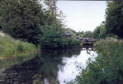
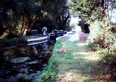
Also at Tirymynach you will find Bridge 109 . Seen here are the bottom gates of Bank Lock framed in the bridge hole. Bank Lock lifts the canal 8'6" from this bottom pound . |
|
|
 |
View looking towards the top gates of Bank Lock. The familiar Montgomery paddle gear stands prominently by the lock side. It would be possible to turn a small boat at this point. |
|
|
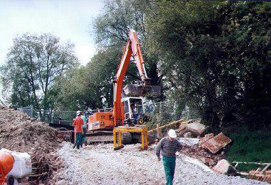 |
At the next lock, Cabin Lock, British Waterways were carrying out major maintenance repairs, namely the rebuilding of the banking and the lock chamber walls. ( June 2000). |
|
|
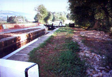 |
This photo was taken from the off-side, by the top of the bottom gate of Cabin Lock, looking in the direction of Welshpool on the 27th of July 2000. All the structural work has been completed and the lock is back in water ready for use. |
|
|
 |
June 2000. Above Cabin Lock a British Waterways team were being closely watched by another family of resident swans that appeared to be totally undisturbed by the intense activity. |
|
|
 |
This is the same area as the above photo after work on the lock and retaining banking had been completed apart from tidying up the site. July 27th 2000. The tranquillity of the area is well expressed in this scene. |
|
|
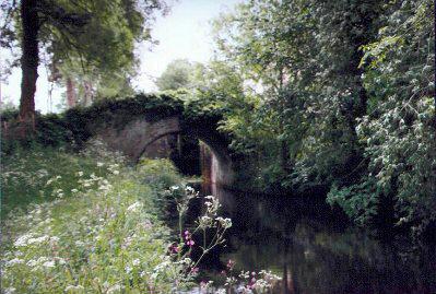 |
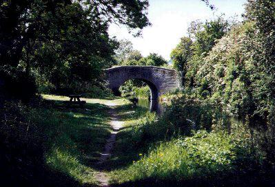
In a pleasantly wooded setting, Bridge 101 frames the bottom gates of Crowther Hall Lock. Crowther Hall Lock has a rise of 9' 2". |
|
|
 |
Above Crowther Hall Lock and the lock keepers cottage, screened by the trees, you will find a winding point. |
|
|
 |
Pool Quay Bridge number 111. Pool Quay Lock has a rise of 8' 11". Once more, a bridge precedes the lock. This lock is the last lock before the long pound that extends to Welshpool. It is on the fringe of the village and you reach it after passing the church. |
|
|
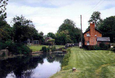 |
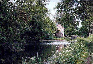
Above Pool Quay Lock is the lock keeper's cottage. Note the mooring bollard standing prominently on the approach. The frequency of these cottages gives one an idea of how busy the canal was in it's heyday. Pool Quay itself was once a busy inland port with boats of up to 50 tons navigating the Severn up to this point. For a short period it served as a transhipment point. |
|
|
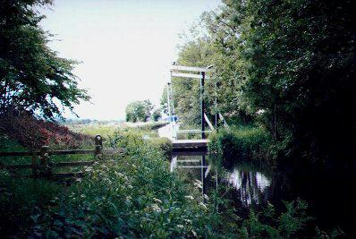 |
The Offa's Dyke long distance footpath follows the towpath along this section before you reach the Abbey Lift Bridge (Bridge 112). The bridge gains it's name from the site of the Strata Marcella Abbey which, on dissolution of the monasteries had left light industries that provided the canal with some of it's business. |
|
|
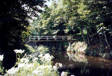 |
Leaving the road, you pass a winding point. The canal then follows the edge of a steeply wooded hillside before you come to a footbridge (Bridge 113) carrying a path from the road across a wetland area and into the woods. |
|
|
 |
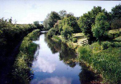
From the footbridge (Bridge 113), the views across the Severn Valley are superb. This photo towards Welshpool doesn't do them justice. |
|
|
 |
The Moors Farm Lift Bridge (Bridge 114) seen here as we approach Buttington, is adjacent to the farm that houses The Moors Bird Collection which is worthy of a visit. |
|
|
 |
Arriving at Buttington Wharf you will find a picnic area adjacent to the sites of the lime kilns. The kilns are hidden from view by the trees and shrubs but can still be seen. |
|
|
 |
A vantage point on the top of Buttington Bridge (No. 115) At Buttington Cross gives views west towards Welshpool, approximately 1 mile distant. |
|
|
|
|
|
|
|
|
|
|
|
|
|
|
|
|
BACK to homepage. |
Pete's MONTGOMERY CANAL Website |
Send me an E-MAIL |
|
|
|
|
|
|
|


