| Carreghofa to Four Crosses section. |
| |
| This section is included for interest (and future restoration). As changes occur, you will find additional photo's and information added to the pages. |
| The pages have been created without "frames" to reduce problems for some browsers. If you take time to read the script, the photo's should load as you scroll down. |
| |
 |
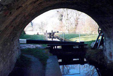
Approaching the top of the Carreghofa Locks. The Tanat Feeder is seen to the centre-right of the photo. The feeder, first opened in 1822, brings water from the top of a weir across the River Tanat situated over a mile away. It was intended to make the feeder navigable and extend it as far as the Quarry at Porthywaen but this was never completed. |
|
|
|
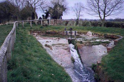 |
This side pond with sluice is an interesting feature to be found by the top of the top lock at Carreghofa. A seat provided at the eastern end of the pond creates a a pleasant place to rest on a fine day . |
|
|
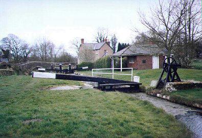 |
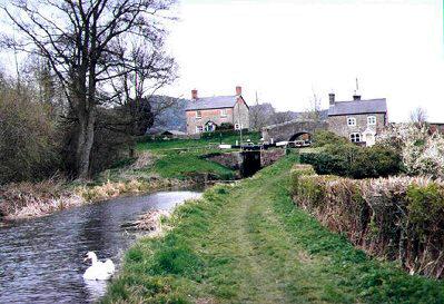
Adjacent to the top lock at Carreghofa is to be found the original Toll House. It was sited here as this was where the Ellesmere Canal joined the Montgomery Canal. (The two canals linking Frankton on the Llangollen Canal and Newtown, Powys are now refered to jointly as "The Montgomery Canal." This junction was so busy at one time as to warrant the employment of two men. A toll clerk and a lock keeper. |
|
|
|
|
|
|
|
|
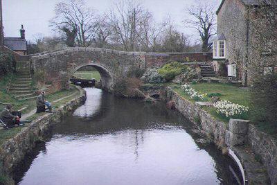 |
Below the top lock, anglers enjoy a sheltered spot adjacent to the well kept gardens of the lock cottage on the northern side of Bridge 95. This is a popular venue. |
|
|
 |
The top gate of Carreghofa Bottom Lock is seen framed by the structure of Bridge 95. The paddle gear that you can see to the right of the lock is unique to the "Montgomery". Instead of the usual practice of vertical paddles set in the side wall, this gear draws a paddle horizontally across a culvert in the bottom of the canal. Surprisingly, very little trouble has been experienced with this set up. |
|
|
 |
Looking east and back towards the bottom lock at Carreghofa, a friendly swan cruises quietly by. |
|
|
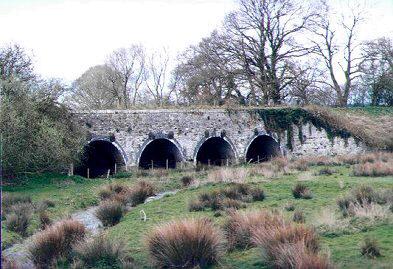 |
Further west, towards Newbridge, flood arches passing through the embankment remind us of the close proximity of the River Vyrnwy. The ground around around this area is subject to flooding when the river reaches peak levels. |
|
|
|
|
|
|
|
|
 |
The next obstacle to the restoration is to be found at the flatted Williams Bridge, number 96. The road over this bridge, now only a minor road, used to carry the main route between Oswestry anad Welshpool. |
|
|
 |
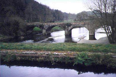
Newbridge Aqueduct. The site of many self sealing leaks over the years. Engineered by the Dadfords, many problems were experienced both during and after construction. Note the many "temporary" tie bars and girder cradles on the structure to prevent it bulging. |
|
|
|
|
|
|
|
|
 |
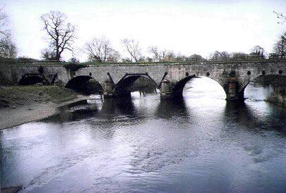
The Newbridge road bridge is seen here crossing the River Vyrnwy west of the aqueduct as you stand on the centre of the towpath. As previously stated, this bridge used to carry the main Oswestry to Welshpool road before the more direct route via Four Crosses was constructed. |
|
|
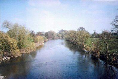 |
This scene to the east along the course of the river was taken from the towpath of the Vyrnwy Aqueduct and is a very picturesque setting. |
|
|
|
|
|
|
|
|
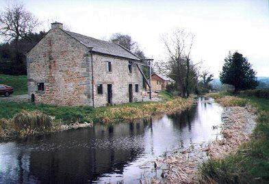 |
The old salt warehouse by the side of the canal at Pentrehelyn is now a private residence. Care taken during its restoration has preserved for posterity this fine example of a canal side crane that you can see here by the side of the building. |
|
|
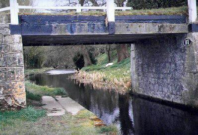 |
Pentrehelyn Bridge, number 97, is constructed with the deck formed of cast iron girders. The supporting buttresses are constructed of stone. Pentrehelyn Hall, also of stone construction, used to be seen from the canal but sadly is no longer with us. |
|
|
|
|
|
|
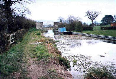 |
Signs of recent bank repairs and a British Waterways workboat moored near to Parsons Bridge are a reminder of the ongoing restoration movement. Offa's Dyke long distance footpath passes by this bridge. |
|
|
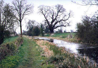 |
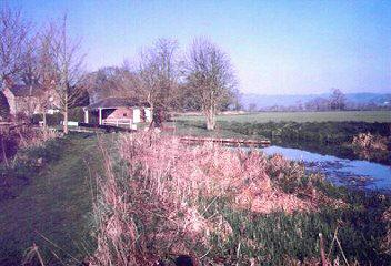
Passing through open farmland. A quiet section before reaching Four Crosses. |
|
|
|
|
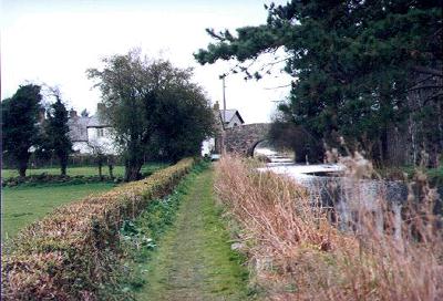 |
Canal House Bridge, number 100, (also known as Clafton Bridge) , is seen here as you approach Four Crosses. This was the site of Cloptons Wharf and has winding holes on either side of the bridge. Traces of a crane support can still be found but no signs of the dry dock or lime kilns, in use as recently as 1938, can be found. |
|
|
|
|
|
|
|
|


