| Llanymynech to Carreghofa section. |
| This next section is included for interest (and future restoration work). As changes occur you will find additional photo's and information added to the page. |
| |
| These pages have been created without "frames" to reduce problems for some browsers. |
| |
| If you take time to read the script, the photo's should load as you scroll down. |
| |
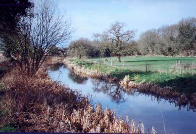 |
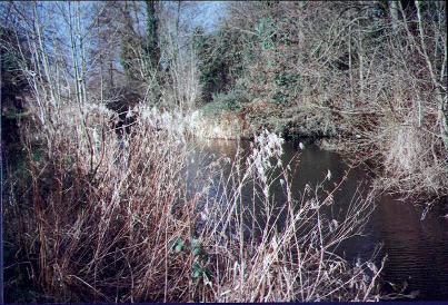
As we leave the railway embankment and head towards Llanymynech the canal is now in water. Although not quite up to it's original level, there is plenty depth for portable craft and fishing. |
|
|
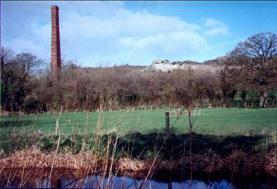 |
Looking across the canal in the direction of Llanymynech Hill, evidence of the areas industial past can be seen in the form of a derelict works chimney. This chimney was the chimney of the Warren continuous lime kiln that had ceased production in 1914. |
|
|
|
|
 |
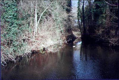
Further along, as you approach the wharf area, hidden by scrub, you will find remains of the stone bank retaining walls . |
|
|
 |
Hidden by trees, the entrance to one of the loading wharves comes into view. Edge-rail tramways that ran parallel to one another after emerging from tunnels under the main Oswestry to Welshpool road, used to bring lime down inclined tracks from Llanymynech Quarries to two V shaped wharves. |
|
|
 |
The entrance to a loading arm is well hidden by overgrown trees, shrubs and brambles. Standing here in the peace and tranquility of a warm spring day, it is hard to imagine the noise and bustle of it's past. |
|
|
 |
A gap in the herbage reveals more of the wharf area. Wild life in the form of a Mallard drake quietly swims between the two banks. |
|
|
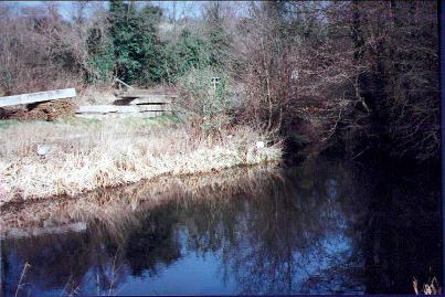 |
The wharf at British Waterways, Llanymynech maintenance yard. Adjacent to the yard, with access from the A483 trunk road, is a car park for the use of visitors to the Llanymynech Heritage Area. |
|
|
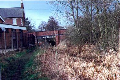 |
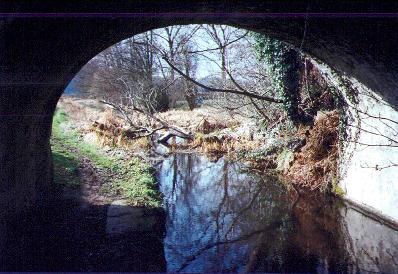
The road bridge carrying the A483 Swansea Trunk Road. Timber supports are erected under the centre of the bridge which was never designed to carry today's excessively heavy vehicles. On the western side of the bridge, stop planks are in place to maintain a higher level of water than the level to the east. There is also abundant reed growth. |
|
|
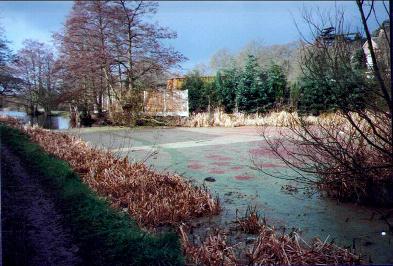 |
On the south side of Llanymynech Road Bridge, we come to a winding point. Duck weed, reeds and rubbish at present cover the whole of the area. |
|
|
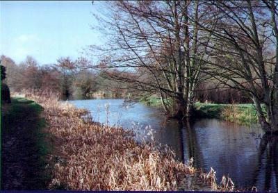 |
As we leave the vilage centre and travel in the direction of Carreghofa, the canal widens and once more becomes attractive. |
|
|
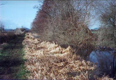 |
Overgrown trees from the offside of the channel block the canal as we approach Walls Bridge. The towpath at this point is in good condition and provides a good surface for walking. |
|
|
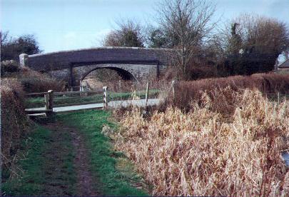 |
Walls Bridge. On the approach to Walls Bridge we come to the next obstacle in the path of restoration. The road that used to pass over the bridge now passes over a flatted bridge and completely blocks the canal. |
|
|
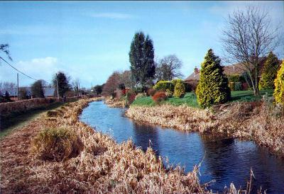 |
The attractively maintained gardens of modern housing adjacent to the canal and extending down to the water's edge are a feature of this section. |
|
|
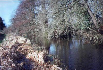 |
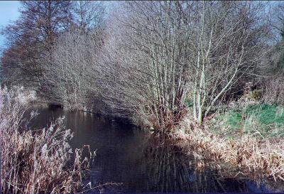
Leaving the residential area the canal once more heads out into the countryside where again we find trees completely blocking the path of any portable craft that are prepared to venture here. |
|
|
 |
This photo was taken on the top of the Wern Aqueduct. The Llanfyllin line of the Great Western Railway used to pass below this point, as did the original line feeding Blodwell and Nantmawr. |
|
|
 |
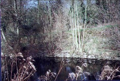
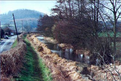
This attractive scene was taken towards Llanymynech Rocks Nature Reserve ( limestone cliffs rising to around 500 foot). Nearby, a partially obscured winding point is to be found after leaving the aqueduct and heading towards Carreghofa. |
|
|
 |
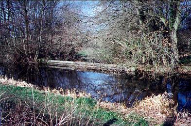
Bridge 94 at the Wern. Passing through the bridge, the last before Carreghofa Locks, we found the fallen trunk of a dead tree that was completely blocking the canal. (This has since been removed.) |
|
|
 |
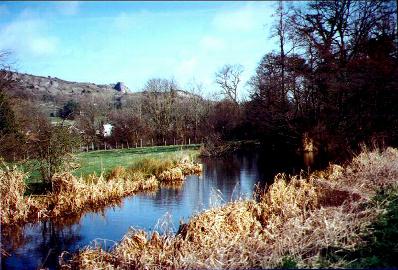
The view towards Carreghofa taken from the summit of Bridge Number 94. |
|
|
|
|
|
|
BACK TO HOMEPAGE. |
Pete's MONTGOMERY CANAL Website. |
Contact the Webmaster. |
|
|
|
|
|


