| Welshpool to Belan Locks section. |
| This next section is included for interest. As changes occur you will find additional photo's and information added to the page. |
| |
| These pages have been created without "frames" to reduce problems for some browsers. |
| |
| If you take time to read the script, the photo's should load as you scroll down. |
| |
|
 |
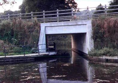
Gallowstree Bridge (117) at Welshpool. This is the new bridge of concrete construction that was built to replace the flatted bridge carrying the main Oswestry to Welshpool road. A peculiarity of it's construction is that it was built without a towpath as you can see from the photo. |
|
|
|
|
 |
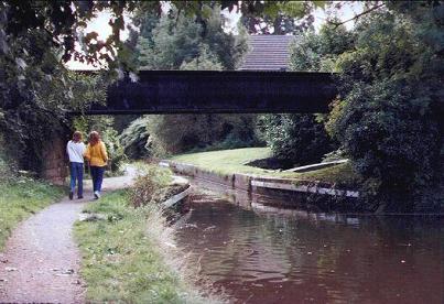
Clerks Bridge (118) on Mill Lane. This bridge replaced the original Clerks Bridge and was constructed to carry heavy traffic from the main Oswestry / Welshpool road down to the cattle market prior to the construction of the Welshpool Bypass. |
|
|
 |
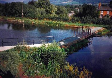
Adjacent to Clerks Bridge, is the new Welshpool Wharf for boats visiting the town. It was constructed adjacent to the main car park and cattle market. The original slipway was replaced by the new concrete ramp that you can see to the far left. |
|
|
 |
Bridge 118a used to carry the Llanfair to Welspool narrow gauge railway to the Livestock Market and the Cambrian Railways main line station. The very popular light railway now terminates at Raven Square at the top of the main street. |
|
|
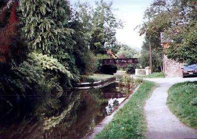 |
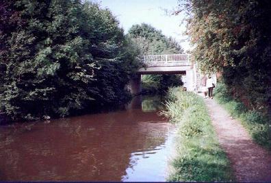
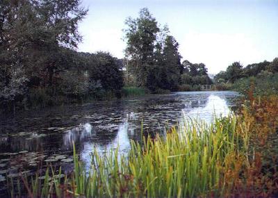
This view from the western side of bridge 18a shows the narrows that mark the aqueduct over the Lledan Brook. To the right of the photo, by the railings, you can see an original canal warehouse. To the left of the canal, now covered by shrubs and trees, was a former stone wharf. |
|
|
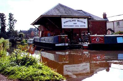 |
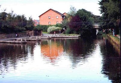
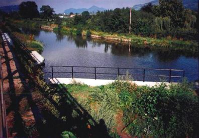
Passing through Severn Street Bridge (119) you are faced with the entrance to the POWYSLAND MUSEUM AND MONTGOMERY CANAL CENTRE on the offside of the canal. In front of the museum that is housed in an attractive old canal warehouse of a unique architecture, is a V shaped basin. The basin is used as a winding point and also as a base for the Montgomery Canal Cruises, (see my information page). The museum is worthy of a visit if you get time. |
|
|
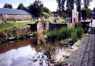 |
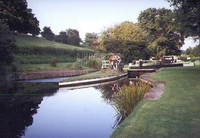
Welshpool Town Lock. ( 5'10" rise). The original lock gates and beams were of cast iron construction. These had been removed to the Inland Waterways Museum at Stoke Bruerne at the time of the official closure of the canal. To the right of the lock , you can see the site of the Mill Wheel that was driven by water from the by-weir and used to power a corn mill. |
|
|
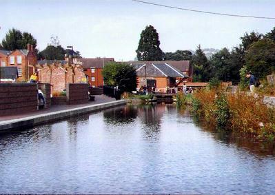 |
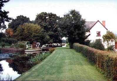
Looking back towards the top of the Town Lock. The canal is quite wide at this point. And provides plenty room to moor by the side of the supermarket car park if you want to stock up with provisions. |
|
|
 |
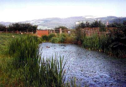
The nature reserve on the line of the old canal at Ty-Gwyn on the approach to the dropped Whitehouse Bridge, has now matured and provides a very attractive setting. You can just see a footbridge in the distance carrying the towpath over the entrance |
|
|
 |
A closer, more detailed view of the previously mentioned footbridge carrying the towpath over the entrance to the nature reserve at Whitehouse Bridge. This photo was taken shortly after its construction. |
|
|
 |
View from the top of Whitehouse Bridge showing the approach to the entrance of the newly constructed bridge and canal diversion. |
|
|
 |
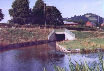
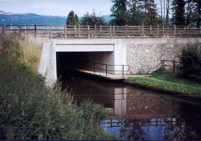
Entrance to the new Whitehouse road bridge (120.) The bridge is of concrete construction and has a towpath incorporated . This bridge was built to replace a flatted bridge. A short, new section of canal was constructed to bypass the nature reserve and join the original line of the canal near to the Powis Estate Sawmill and site of the old Bonemill. |
|
|
 |
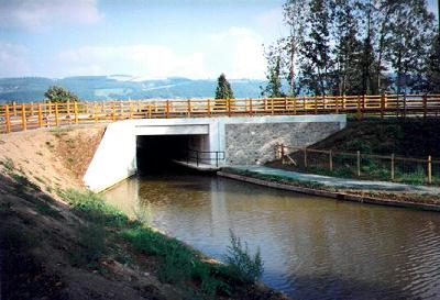
The western side of Whitehouse Bridge (120). Although of modern design and concrete construction the new bridge is faced with stone and, as the area begins to mature, it has begun to blend in with it's surroundings. |
|
|
 |
This view is of the same bridge entrance as our previous photo but was taken just after it's construction. Compare the difference. |
|
|
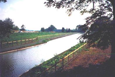 |
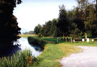
The new section of canal that was built to bypass the Whitehouse nature reserve. This new section is of similar construction to the lenth of canal between Frankton Locks and the Perry Aqueduct. Below waterline, it has matured well and I am assured by local anglers that it provides excellent fishing |
|
|
 |
The flatted Whitehouse bridge as seen along a short, original canal line, nature reserve on the western side of the Welshpool to Newtown road. |
|
|
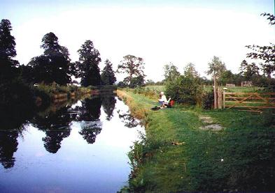 |
This is the site where the new section of canal joins the original channel. The canal swung off to the right approximately where the angler is sitting and joined the section of canal displayed in the previous photo. |
|
|
|
|
 |
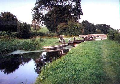
Belan Bottom Lock (5 foot rise), showing the Lockside Cottage and familiar Montgomery Paddle Gear by the top gate. |
|
|
 |
Another view of the previous lock-side area showing the broad by-weir and well kept lock and lock-side garden. |
|
|
 |
Belan Locks Picnic Area. By the site of the old lime kilns and wharf. You can spend a pleasant afternoon around this area. |
|
|
 |
Belan Road Bridge (121) and Belan Top Lock (7 foot rise ). The area adjacent to the locks was very busy in the early nineteenth century when, in addition to the lime trade, brickworks and timber-loading wharfage was evident.
|
|
|
|
|
|
|
|
|
|
| BACK TO HOMEPAGE. |
Pete's MONTGOMERY CANAL Website. |
Contact the Webmaster. |
|
|
|
|
|


